Randonnée Marche La Bâtie-Rolland - La Batie-Rolland  Les Trois Panorama7km - Photo

La Batie-Rolland Les Trois Panorama7km

 chancha
chancha

Utilisateur

© OpenStreetMap contributors
Longueur
Longueur
6,4 km
Altitude max
Altitude max
198 m
Dénivelé positif
Dénivelé positif
96 m
Km-Effort
Km-Effort  
7,7 km
Altitude min
Altitude min
144 m
Dénivelé négatif
Dénivelé négatif
99 m
Boucle
Boucle
Oui
Date de création :
2022-07-05 06:46:40.095
Dernière modification :
2022-12-13 07:36:51.179

(0 Avis)

Marche
Marche
1h56
Difficulté : Facile

Scannez ce code QR pour ouvrir la randonnée dans l'application SityTrail

Application GPS de randonnée GRATUITE

Logo SityTrail SityTrail

IGN / Instituts géographiques

Télécharger SityTrail sur l'App Store Télécharger SityTrail sur Google Play

Logo SityTrail SityTrail World

Le monde est à vous

Télécharger SityTrail sur l'App Store Télécharger SityTrail sur Google Play Télécharger SityTrail sur Huawei AppGallery

À propos

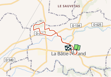
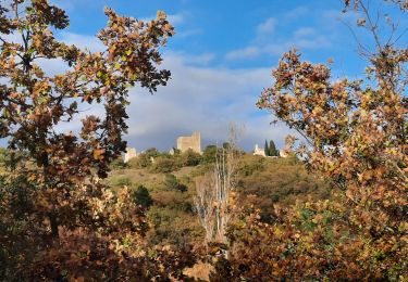
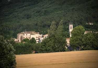
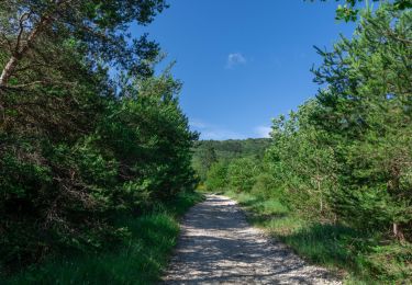
Randonnée Marche de 6,4 km à découvrir à Auvergne-Rhône-Alpes, Drôme, La Bâtie-Rolland. Cette randonnée est proposée par chancha.

Description

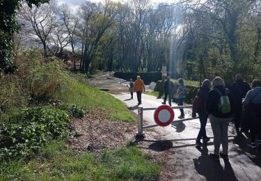
Cette petite randonnée familiale vous mène de Saint-Roc a Saint-Andéol par des chemins sans difficultés.

Profil altimétrique

Photos

Localisation

Pays :
France
Région :
Auvergne-Rhône-Alpes
Département/Province :
Drôme
Commune :
La Bâtie-Rolland
Localité :
Unknown
Départ:(UTM)
648218 ; 4935035 (31T) N.

Randonnées à proximité

Randonnée Marche Portes-en-Valdaine - Portes en Valdaine la plaine 7km - Photo
Marche
GUIDE
thonyc

Marche

Facile
(1)
Portes-en-Valdaine, Auvergne-Rhône-Alpes, Drôme, France
7,1 km | 8,2 km-effort
2h 0min
Oui
Randonnée Marche Portes-en-Valdaine - Portes-en-Valdaine Serre-de-Mirabel 11km. - Photo
Marche
chancha

Marche

Difficile
(1)
Portes-en-Valdaine, Auvergne-Rhône-Alpes, Drôme, France
10,8 km | 14,7 km-effort
3h 20min
Oui
Randonnée V.T.T. Puygiron - Puygiron VTT n°5 - Photo
V.T.T.
tracegps

V.T.T.

Très difficile
(1)
Puygiron, Auvergne-Rhône-Alpes, Drôme, France
47 km | 60 km-effort
3h 0min
Oui
Randonnée Marche Montboucher-sur-Jabron - 20240428 Rando vieux  - Photo
Marche
Havani

Marche

Très facile
Montboucher-sur-Jabron, Auvergne-Rhône-Alpes, Drôme, France
6,1 km | 6,5 km-effort
5h 17min
Oui
Randonnée Marche Rochefort-en-Valdaine - Rochefort en Valdaine 7,5km - Photo
Marche
GUIDE
thonyc

Marche

Facile
Rochefort-en-Valdaine, Auvergne-Rhône-Alpes, Drôme, France
7,3 km | 10,3 km-effort
2h 30min
Oui
Randonnée A pied Portes-en-Valdaine - Randonnée Trail Portes en Valdaine - Photo
A pied
Julie LABBE

A pied

Moyen
(1)
Portes-en-Valdaine, Auvergne-Rhône-Alpes, Drôme, France
19,4 km | 27 km-effort
6h 9min
Oui
Randonnée Marche La Touche - La Touche : Les Citelles et Serre Pointu 12km - Photo
Marche
chancha

Marche

Difficile
La Touche, Auvergne-Rhône-Alpes, Drôme, France
12 km | 16,6 km-effort
4h 3min
Oui
Randonnée Marche La Touche - La Touche Mastaize 9km - Photo
Marche
chancha

Marche

Difficile
La Touche, Auvergne-Rhône-Alpes, Drôme, France
8,6 km | 10,7 km-effort
3h 24min
Oui
Randonnée Marche Espeluche - Bois-Jamot-Espeluche 11km - Photo
Marche
chancha

Marche

Moyen
(1)
Espeluche, Auvergne-Rhône-Alpes, Drôme, France
11,3 km | 15,4 km-effort
3h 28min
Oui


Fermer
Mes abonnements